After a few days’ rest for our sore feet after the Tin Range
tramp, our next big tramp was to Magog. Gog and Magog are two twin peaks
visible from most of Port Pegasus. Gog is the more southern one with the bigger
and more rounded top. When you look at topo
maps and the likes of the whole of the south Stewart Island, there’s just nothing
there! No tracks, nothing. But the
sailing guide has three tramps in it with little hand drawn drawings: the Tin
Range (which we already did, read
this post), Magog, and Bold Cone (post coming
up). However, the guide book is 16 years old, so we weren’t quite sure
what track (if any) to expect. We actually tried to find the start of two tracks both
leading to Magog from Seal Creek (also
named Cooks Arm) which would have shortened the tramp, but we couldn’t find
either (instead we spotted sharks, very exciting, another post about that).
The next day we changed anchorage to Evening Cove and easily found the
start of the track there. The first bit of the track trough the bush up to the
open ridge landscape was easy to follow, but after that we were struggling to
find the track and if we did, we’d lose it again quickly. That meant heaps of
bush bashing through the landscape and looking at the map every 5 minutes. You can kind
of get an idea of what it was like in the first photo. It varied from ankle
high to over-your-head high bush. The most annoying height is when it’s just
about your head height and it’s too high to push your way through but too low
to go under. A good thing was we could see Magog almost the whole way, so at
least we weren’t losing our bearings.
The last stretch up through the bush (above photo) to the
very top was quite steep and it was a nice warm day, especially out of the
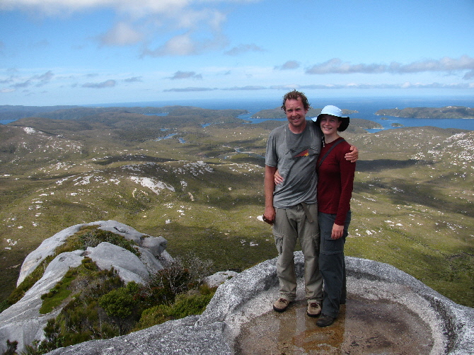
wind, so Phil found a nice little rainwater pool to cool himself of with.
It was a hard tramp, but the view from the top made it all worth it, it was absolutely breathtaking. The guidebook indicated it was 2.5-3 hours to the top of Magog, but it took us closer to 4. Probably because of the elusive track... Phil looks like he's wearing a bathing suit in the photo below and has wet hair from the photo above, but I still love it.
Panorama view of the west coast. The lovely bay with the
beach is Easy Harbour.
You kind of get an idea how big Port Pegasus is from this panorama
view looking north and east. In the middle are a couple of entrances, and it
then stretches both north and south (hence North and South Arm).

Coming back to Sophia someone had kindly left us a gift on
the transom. We never found out who, must have been some fishermen or hunters
in the area. We know it’s almost criminal, but unfortunately neither of us are
big seafood lovers (we love fish though), so we donated the scallops back to
the sea!